Ragnabo Data
Controlled Drainage & Irrigation Website
Land management
Land management is here meant to document all activities you or other organizations make on the farm landscape that could be relevant for planning and development in the future. It is important to save this information over time so it is always traceable backwards.
Changes to landscape are normally seen in longer time scales, that cover over generations. It is therefore important to document for next generation for a seamless transition to next farmer. This is to ensure that no important information is lost.
 Document tools are GIS, CAD and GPS software and a
computer plus a web design tool o publish onto an Internet Service
Provider (ISP). This is to ensure you can read this information as
you are doing right now.
Document tools are GIS, CAD and GPS software and a
computer plus a web design tool o publish onto an Internet Service
Provider (ISP). This is to ensure you can read this information as
you are doing right now.
Document information can be of:
 1: Soil maps, such as P- and K-content of the soil, pH (measurement
of acidity) etc.
1: Soil maps, such as P- and K-content of the soil, pH (measurement
of acidity) etc.
2: Old maps above the farm is of help to understand how the arable
land has evolved over the years. Typically maps can be found that
are 200-300 years old.
3: Infrastructure such as telephone cables, fiber cables, water
pipes, sewer pipes, power supply, etc.
4: Infrastructure capacity, dimensioning or other data if relevant
for farm, such as how deep is the fiber cable or if it is detectable
by a tracking net or does it go under or above something else at
crossing points. It is better to know in advance this than find out
the hard way...by cutting off and see what you are missing.
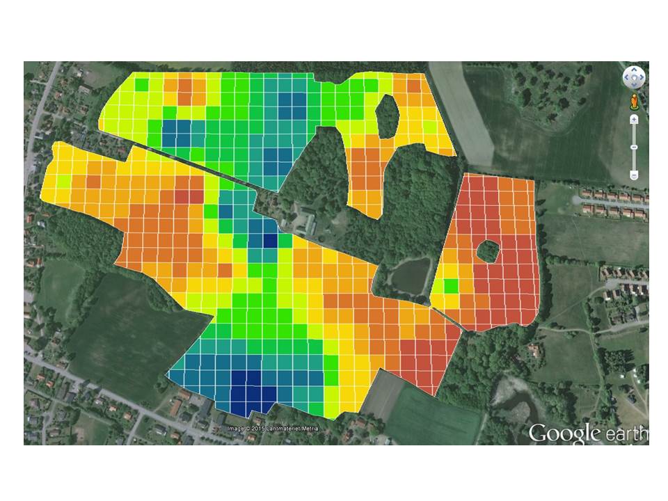
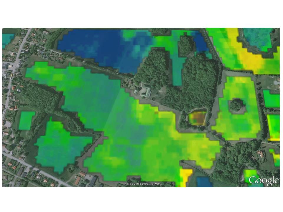 5:
Satellite photos (Biomass maps, the normalized
difference vegetation index, NDVI) and air photos give also interesting
information once you know the time of photo. Then you can correlate
farm activity and crop condition at that particular time stamp.
5:
Satellite photos (Biomass maps, the normalized
difference vegetation index, NDVI) and air photos give also interesting
information once you know the time of photo. Then you can correlate
farm activity and crop condition at that particular time stamp.
Rectifying old and historical maps:
Old maps are often skewed. Rectifying historical maps and add on
as an overlay of today's map clearly shows landscape changes over
time. The tricky thing are normally to find fix points that share same location on all maps. Another problem is the non unified
scale along the old map. Old land surveyors usually put more effort
in creating an accurate maps around houses and buildings. Outer
fields maybe not so accurate mapped. Typically fix point are
old buildings, fences, stone walls and shore lines.
Key Words
- Land infrastructure
- Document info
- Document security
- Tools
- Time & position dimension
- Data format
- Rectifying maps