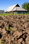
 As
we know the arable land of Ragnabo in the early days was used for grassland and
pasture for the cattle. Smaller and elevated fields were also used as cultivated
land to grow vegetables for the household. Typical field names, such as "Oxgärdet"
(Oxe-field), reveal that cattle, like cows and oxes were used. Oxes were probable
also in addition to horses as driving force for agricultural implements. Other fields
have got their names based on the usage, the owner or other
typical field properties. Some examples of names are given below:
As
we know the arable land of Ragnabo in the early days was used for grassland and
pasture for the cattle. Smaller and elevated fields were also used as cultivated
land to grow vegetables for the household. Typical field names, such as "Oxgärdet"
(Oxe-field), reveal that cattle, like cows and oxes were used. Oxes were probable
also in addition to horses as driving force for agricultural implements. Other fields
have got their names based on the usage, the owner or other
typical field properties. Some examples of names are given below:"Södra hagen" (South-wooded-pasture)
"Storängen" (Big-meadow)
"Änggärde" (Meadow-field)
"Madlyckeskiftet" (Marsh-field)
"Tomtskiften" (Farm-yard)
Some fields have got their names because of the procedure of 'burning up' forest land for creating new arable land. The Swedish old word "Rödsel", locally "Rössel" or "Rössle" meant an area that originated from burning up land. Quite often the old land was of marsh type (wetland) but with the increasing knowledge on how to drain the land, this was not a problem for crop production anymore. Some examples of land names:
"Rössleäng" (Rössle-meadow)
"Rösslehage" (Rössle-wooded-pasture)
"Rössleåker" (Rössle-acre)
"Rösslebacke" (Rössle-hill)
The pathway to the above fields was consequently named "Rösslegatan" (Rössle-path). Field, field names, paths and houses are shown in Map 1874 (Google Map) and LM History 1874 (slide pdf).